December 23, 2025
Marketing for Protest Organizers
What Role Does Visual Communication Play in Marketing for Protest Organizers in California?
California protest organizers can market their gatherings without pushing viewpoints by focusing on visual communication that is safe, lawful, accessible, and service oriented. Think of every poster, snipe, and decal as public infrastructure that reduces confusion and supports respectful behavior. That approach keeps outreach content neutral while helping people move, stay informed, and look out for one another.
When visuals deliver maps, wayfinding, ADA routes, and multilingual notices, they continue to help long after a crowd disperses. People photograph them, share links, and return to resources later. The result is stronger clarity on the street and more confidence across the community.
How can visual communication stay useful after the event ends?
Printed visuals often outlast a single day. If they point to stable URLs, verified resource pages, or phone numbers, they keep working.
Short URL posters can link to archived schedules or updated logistics pages
Small snipes can point to ADA-accessible routes that remain valid for repeat gatherings
QR decals can connect attendees to legal aid hotlines, lost and found, and multilingual guides
Treat visuals like a public service. Clear signage shortens lines at information tents, reduces stress for newcomers, and supports a calm environment. Violence fades from memory. Helpful visuals continue to serve the community.
Why do paper based campaigns still matter in California?
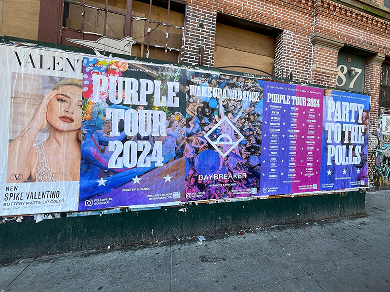
Digital channels move fast. Physical media shapes on the ground behavior and supports people who are not on the same feeds.
Posters build broad awareness of logistics and community guidelines along corridors near civic spaces
Snipes create repetition on commuter paths, emphasizing wayfinding, safety contacts, and meeting points
Decals bridge street level details to verified URLs through QR codes that support live updates and accessibility
Together, these formats reinforce nonviolence, support compliance with city rules, and make it easier for people to participate responsibly.
What types of visuals support safe, lawful public gatherings?
Posters on sanctioned boards or permitted surfaces
Stickers, T shirts, and wearable IDs for volunteers
Projection or mobile screens that display logistics
QR linked decals that point to maps, ADA routes, and help lines
How can visuals support peaceful gatherings in Los Angeles?
Peaceful demonstration example: Climate strike events around City Hall and Pershing Square
Context: Youth led and intergenerational gatherings focused on transit, clean air, and art builds
Population logic:
City population ≈ 3,900,000
Metro population ≈ 13,000,000
Max reach = City population + 0.30 × Metro population = 7,800,000
Downtown daily foot traffic proxy ≈ 0.05 × Metro population ÷ 30 ≈ 21,667
Tactics:
Posters: Broadway, Spring St, 1st to 5th St, and Grand Park with meeting points, ADA routes, interpreter availability, and water stations
Snipes: 7th/Metro and Union Station edges where permitted, plus USC and community college areas for transit egress and safety reminders
Decals: QR paths from Metro exits to City Hall or Pershing Square for live updates, route changes, and medical tent info
Why it works: A multi modal footprint benefits from consistent wayfinding and safety cues that lower confusion and keep a respectful tone
How can visuals guide diverse arrivals in San Francisco?
Peaceful demonstration example: Women’s rights rallies at Civic Center Plaza
Context: Families, students, and community leaders gather for speeches and resource booths
Population logic:
City population ≈ 815,000
Metro population ≈ 4,700,000
Max reach ≈ 2,225,000
Downtown daily foot traffic proxy ≈ 7,833
Tactics:
Posters: Market St from Embarcadero to Civic Center with multilingual wayfinding, BART and Muni access points, and volunteer check ins
Snipes: Embarcadero, Powell St Station vicinity, and Hayes Valley where permitted to keep safety numbers visible
Decals: BART and Muni exits to Civic Center Plaza with QR to ASL schedules and accessible seating
Why it works: Multilingual, precise guidance supports accessibility and calm movement in a dense arrival zone
How can visuals improve calm movement in San Diego?
Peaceful demonstration example: Immigrant rights vigils in Balboa Park
Context: Community led gatherings with music, art, and family participation
Population logic:
City population ≈ 1,380,000
Metro population ≈ 3,300,000
Max reach = 2,370,000
Downtown daily foot traffic proxy ≈ 5,500
Tactics:
Posters: Park adjacent corridors near El Prado and Sixth Ave guiding to lawns, restrooms, hydration, within park rules
Snipes: Transit nodes near Fifth Ave, Gaslamp, and UCSD exchanges where permitted, highlighting trains, buses, and exits
Decals: QR links from trolley stops to rally points with bilingual resources and lost child protocols
Why it works: Transit arrivals and family needs benefit from clear wayfinding and gentle, service oriented cues
How can visuals stabilize mixed commuter and student zones in San Jose?
Peaceful demonstration example: Workers’ rights and tech accountability rallies near City Hall
Context: Peaceful gatherings by workers, students, and families
Population logic:
City population ≈ 1,000,000
Metro population ≈ 2,000,000
Max reach = 1,600,000
Downtown daily foot traffic proxy ≈ 3,333
Tactics:
Posters: Santa Clara St and City Hall perimeters with permitted assembly maps and egress routes
Snipes: Diridon Station and SJSU surroundings where allowed, repeating code of conduct and medical tent locations
Decals: Transit exits to City Hall Plaza with QR to volunteer shifts and multilingual help lines
Why it works: Consistent safety and logistics info supports a mixed audience and reduces friction
How can visuals clarify space use at the Capitol in Sacramento?
Peaceful demonstration example: Education funding rallies around the Capitol
Context: Teachers, parents, and students gather for speeches and sign making
Population logic:
City population ≈ 525,000
Metro population ≈ 2,400,000
Max reach = 1,245,000
Downtown daily foot traffic proxy ≈ 4,000
Tactics:
Posters: Capitol Mall and K St with directions to assembly areas, bathrooms, and quiet zones
Snipes: Light rail corridors and Old Sacramento edges where permitted, repeating safety contacts and departure routes
Decals: Transit exits to Capitol grounds with QR for live updates and ADA maps
Why it works: Clear signage lowers confusion among workers, visitors, and families sharing the same grounds
Which quantitative planning framework supports neutral campaigns?
The variables below set content neutral, safety focused coverage ranges. Always adjust for permits, local codes, and environmental goals.
Poster_Count: 0.05 to 0.1 per 1,000 city residents, often 200 to 800 in larger cities
Snipe_Count: 2 times Poster_Count where allowed
Decal_Count: 0.02 times Poster_Count on removable, approved materials
Campaign_Duration_Days: 14 to 28, aligned with permits and cleanup commitments
Downtown_Daily_Foot_Traffic: proxy set to (0.05 × Metro_Pop) ÷ 30
Max_Reach: City_Pop + 0.30 × Metro_Pop, interpreted as an upper bound on unique people who might benefit
Core metrics
Awareness via posters:
Gross traffic impressions GTI = Poster_Count × 2,000 impressions per day × Campaign_Duration_Days
Unique Reach = GTI × 0.35, capped at Max_Reach
Snipes:
Audience = Awareness × 0.45
Engagement = Audience × 0.03 interpreted as people who use wayfinding or safety info
Decals:
Audience = Awareness × 0.25
QR Visits = Audience × 0.008 interpreted as scans to logistics pages
Virality:
(Engagement + QR Visits) × 0.01 to approximate shares of maps or helpful tips
Scale adjustment
If City_Pop is under 300k, reduce counts by 40 percent to fit smaller footprints
What do sample results look like across major California cities?
All figures are rounded and framed as informational exposure to non promotional resources.
City
City Pop
Metro Pop
Max Reach
Poster_Count
Snipe_Count
Decal_Count
Duration (days)
Awareness (Unique)
Engagement from Snipes
Info Access from Decals
Virality
Los Angeles
3.9 M
13.0 M
7.8 M
800
1600
16
28
7.8 M
105,300
15,600
1,208
San Francisco
815,000
4.7 M
2.225 M
500
1000
10
21
2.225 M
30,038
4,450
345
San Diego
1.38 M
3.3 M
2.37 M
600
1200
12
21
2.37 M
32,000
4,740
368
San Jose
1.0 M
2.0 M
1.6 M
450
900
9
21
1.6 M
21,600
3,200
248
Sacramento
525,000
2.4 M
1.245 M
300
600
6
14
1.245 M
16,808
2,490
193
Notes
Counts sit within typical ranges but must be validated with permission frameworks and environmental goals
All placements require property owner consent, municipal code compliance, and formal cleanup commitments
San Francisco duration is set to 21 days to match faster weathering and board turnover
How do design principles keep visuals readable, inclusive, and city compliant?
Readability
Large sans serif type, few words, strong contrast like black on white or yellow
Rough rule: 1 inch of letter height per 10 feet of viewing distance
Ample white space, bold icons, consistent visual hierarchy
Color and symbolism
Red can suggest urgency, blue can signal calm or trust, green can fit environmental themes
Local cues help residents connect quickly, for example the California bear, Golden Gate silhouette, or bilingual text
Materials and form factor
San Francisco permits narrow, dated utility pole signs under strict limits on height and attachment method
Los Angeles prohibits posting on many public fixtures, so rely on handheld signs, private property permission, or sanctioned boards
Keep sidewalks and ramps clear, and avoid obstructing traffic or safety devices
Accessibility
High contrast, large fonts, clear icons, and bilingual or multilingual versions
Place signs at wheelchair height along accessible routes
Provide QR links to large type PDFs, audio versions, captions, and ASL schedules
What quantitative methods help optimize placement without targeting viewpoints?
Crowd and traffic data
Use anonymized city data, volunteer counts, or permitted route maps to spot dense locations
Simple on the day observation can shift staff to chokepoints where wayfinding is needed most
Spatial analysis
Map rally start and end nodes, transit hubs, and corridors with good visibility
Use basic A B tests with QR codes to compare scan rates at two sites, then scale the winner
Iteration
Track pickup rates for flyers and replace low performing placements with higher value zones
Record where confusion occurs and add decals or snipes near those spots on the next day
These approaches focus on safety, accessibility, and clarity. None of them target beliefs or attempt persuasion.
Where do viral opportunities exist without promoting a viewpoint?
Service visuals spread when they are useful, clear, and easy to share.
Posters near landmarks help people orient quickly and become photo worthy maps
QR codes to multilingual guides and ADA routes inspire word of mouth because they help people participate
Snipes in arts districts and campuses, where permitted, create a recognizable backdrop that shows up in photos and short videos
One short video walking from a train platform to a clearly marked assembly point can be shared widely and reduce confusion
When the emphasis is service, people share because it helps their friends arrive safe, hydrated, and informed.
How does a statewide awareness to impact snapshot look?
These percentages illustrate how neutral, service oriented visuals can improve clarity and safety across a series of gatherings. Assumes mid range durations and saturation similar to the sample cities.
Metric
Pre Campaign Avg
Post Campaign Avg
% Lift
Primary Driver
Awareness of logistics and safety
25%
64%
+156%
Poster saturation across civic corridors
Engagement with wayfinding
12%
36%
+200%
Repetition via snipes on commuter paths
Information access via QR
10%
41%
+310%
Decals that point to verified logistics pages
Virality of helpful info
3%
12%
+300%
User generated content featuring maps and route videos
How can consistent service visuals build momentum across the state?
Standardized resource icons and layouts raise recognition and trust. A unified set of symbols for water, medics, ADA routes, and quiet zones helps people locate support instantly in any city. Volunteers can reuse templates, reduce production time, and keep the look steady. That consistency signals professionalism to neighbors, media, and public agencies, which supports calm coordination.
Repeated exposure strengthens memory. Over time, participants will recognize the water droplet, blue cross, or wheelchair route icon without reading a word. That cuts response time when people need help and reduces strain on volunteer teams.
What legal, environmental, and accessibility practices should guide every install?
Legal
Carry signs and distribute flyers on public sidewalks, subject to time, place, and manner rules
Follow city codes on posting. Los Angeles prohibits affixing signs to many public fixtures. San Francisco allows small dated utility pole postings that meet strict specs
Secure permits for marches, large banners, or street closures. Never attach to traffic signals or obstruct walkways
Respect removal timelines, avoid repeat offense penalties, and document cleanup
Environmental
Use recyclable paper or cloth, low VOC inks, and removable adhesives
Attach with reusable ties or biodegradable string rather than tape or staples when possible
Print only what you need. Rely on QR codes to host deeper info online
Plan for removal and recycling. Bring bags, assign a cleanup lead, and leave no trace
Accessibility
High contrast palettes, large sans serif type, clear icons
Bilingual or multilingual versions based on local demographics
Signs visible at wheelchair height, with routes kept clear
Online materials with alt text, captions, and large type PDFs
Which checklist keeps field teams on track?
Confirm permits, zones, and service hours
Map arrival routes from transit and rideshare
Prepare bilingual or multilingual versions
Publish a mobile friendly page for updates and accessible downloads
Assign a cleanup lead, set takedown reminders, and document removal
Stage extra ties, tape alternatives, and hydration signage in the install kit
What should you look for in a compliant print and installation partner?
Ability to produce at scale within 24 to 48 hours
Recyclable stocks and low VOC inks
Installation only where permitted, with photo records of placements
Removal services with recycling receipts
Familiarity with local posting rules and ADA considerations
Capacity to generate bilingual layouts and high contrast, large type designs
Who can you contact for compliant support focused on safety and accessibility?
If you need content neutral print, mapping, and installation support for public gatherings in California, contact Campaign Strategist Justin Phillips at [email protected]. The right partner will treat your visuals as public service infrastructure that eases movement, protects access, and keeps neighbors informed.